

Cell phone technology nears completion
After five years of research, USF’s Center for Urban Transportation Research (CUTR) and the Department of Computer Science and Engineering hope to have their cell phone applications on the market within the next year.
A research team of five CUTR faculty members is in the process of negotiating licenses to release cell phone applications that feature location-aware information technology.
The research, which is funded by grants, started with the idea and development of a tracking device for transit systems and evolved into the development of numerous projects based on Global Positioning Systems (GPS) and location-based services.
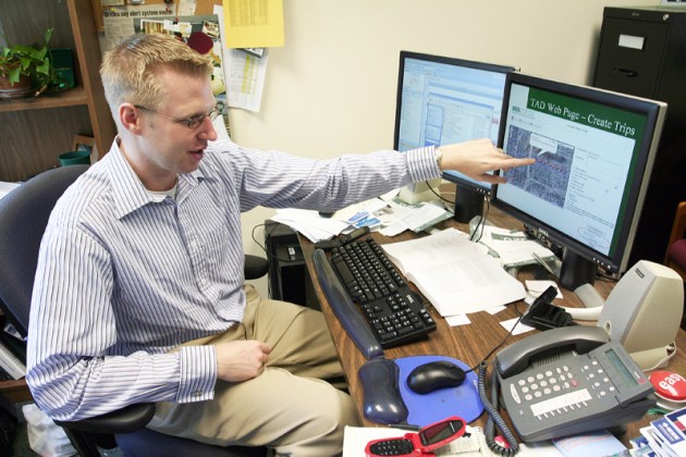
These cell phone applications provide personalized information in real time. For example, the Travel Assistance Device (TAD) can be used to plan trips online and store them for future reference.
Trips are stored on the TAD Web site, from which the data is sent to the cell-phone numbers provided.
The TAD can also be used for public transit routes. While riding public transportation, a TAD user would receive a sound or vibration alert advising him or her to pull the cord as the bus neared the correct stop.
“A lot of times, knowing when to get on the bus isn’t the problem,” said Sean Barbeau, a research associate at CUTR. “It’s getting off the bus that’s the problem, because you know if you pull the cord too early or too late you probably have a lengthy walk.”
This transportation technology would also help transit authorities adjust and manage their routes and the data gathered on users’ tendencies would help determine where new roads and highways should be built.
Another application, the Wi-Via System, features location-based messaging to integrate the use of camera phones during emergency situations.
The 2005 transit bombings in London prompted researchers to design an application for this purpose. Though photos of the bombings were sent to London authorities, some officials were dispatched to the wrong location because picture messages only display the cell phone number.
With the Wi-Via, authorities would be able to view the pictures on a Web site and pinpoint the location where the photo or video was sent. The application would also feature a “Call” link that would connect a call to the sender of the photo, which would be useful and potentially life-saving during terrorist attacks and Amber Alerts, Barbeau said.
“It’s like a next-generation 911,” he said. “It would take advantage of the eyes and ears of the general public.”
Another application, the Hurricane Evacuation Zone Finder, can tell people what evacuation zone they are in and update them about their zone’s status whenever it changes.
A personalized message might read, “Evacuation Zone = B, Evacuate when sustained winds = 30+ mph, Tide = 13+ ft, or when advised. You are currently NOT under a mandatory evacuation.”
This application can also direct people to the nearest pet-friendly shelter, since many people cite pets as reasons for not evacuating for a hurricane, Barbeau said.
He said the costs of these applications has not been determined yet, but they are designed to be as inexpensive as possible.
Barbeau and Nevins Georggi, a transportation engineer and member of the CUTR research team, said their work is “challenging but rewarding.”
“You feel like you’re part of the future,” Georggi said.
The applications will most likely be available to download on CUTR’s Web site, said Barbeau.
They have been tested on Sprint and Nextel phones.
Sprint is the only company that has agreed to use the applications, but the research team is trying to get others involved, said Georggi.
“I hope people see that we’re all in this together and this technology benefits everybody,” she said.
More Stories

USF gives it away in Memphis 34-33
At the half, a 14-point lead meant USF was on track to win its first conference game in over a calendar year. That energy was kept up even with under five minutes to go when the Bulls were up 33-20. Then USF watched as its lead went from comfortable, to slim, to nonexistent in the […]

Club teams missing competition, friendship due to COVID-19
Under normal circumstances, Grant Nolder, president of the USF flag football team would be preparing for the club’s biggest competition of the year, the Swamp Bowl. The annual tournament, hosted at UF, typically takes place during the fall semester and features some of the best club flag football teams in the country. Winners of the […]

Bulls battle with ECU in OT win
Coach Brian Gregory said Tuesday the Bulls didn’t play complete, 40-minute games in their two losses last week. It’s debatable if they did Wednesday night against East Carolina (11-18, 5-11) at the Yuengling Center, but it was more than enough to put up a 73-68 overtime win. “It’s funny. There were stretches where we played […]

First SG scholarship rewards student leaders
Student Government (SG) launched the first-of-its-kind, merit-based scholarship to students Nov. 5 on USF’s Tampa campus. As a part of Student Body President Britney Deas and Student Body Vice President Travis McCloskey’s platform, Bull S.H.I.F.T., — Success, Health, Innovation, Finance and Tradition — the SG’s Student Leadership Scholarship consists of two merit-based scholarships which will […]

On-campus Jabil institute sparks anticipation from students
A plan drafted on a bar napkin two years ago has now become the USF Jabil Innovation Institute, a multi-million dollar institute combining the College of Engineering and the Muma College of Business. Senior Vice President of Advancement and CEO of the USF Foundation Joel Momberg and Jabil CEO Mark Mondello jotted the idea down […]